Accuracy is in the air

Find out how drone photogrammetry can make a difference to your business!

Speed, accuracy and reliability:
our drones are the best choice for your engineering surveys.

We are the ideal partner for engineering firms looking for innovative and customized solutions for their drone and photogrammetry survey projects. We are committed to guaranteeing our customers high quality products and services, offering them reliability and professionalism in the sector. We are always looking for new technologies and methodologies to constantly improve our products and services, in order to better meet the needs of our customers. Find out more on our website and contact us with any questions or requests for information. We look forward to working with you to take your projects to the next level

drone che esegue la fotogrammetria
3D MODELS

With the use of SAPR and photogrammetry, it is possible to detect and reconstruct 3D models of real environments. The return can take place via a 3D viewer, by exporting 3D point clouds that can be imported into a cad environment for subsequent cad and BIM processing.

Inspection
photovoltaic fields

To keep the efficiency of photovoltaic systems high, it is essential to check the state of conservation of the panels and, in the event of problems, to intervene quickly, thus avoiding losing production capacity.

Reliefs
of the ground

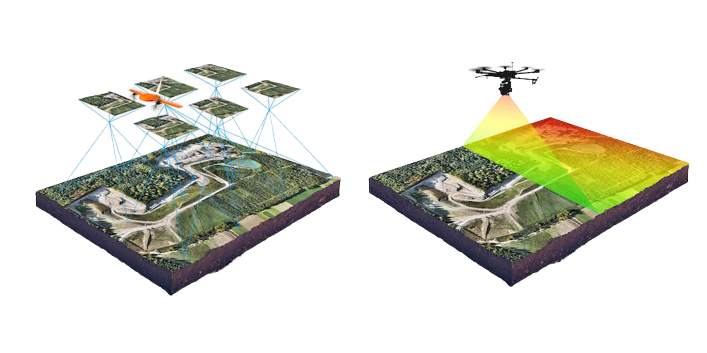
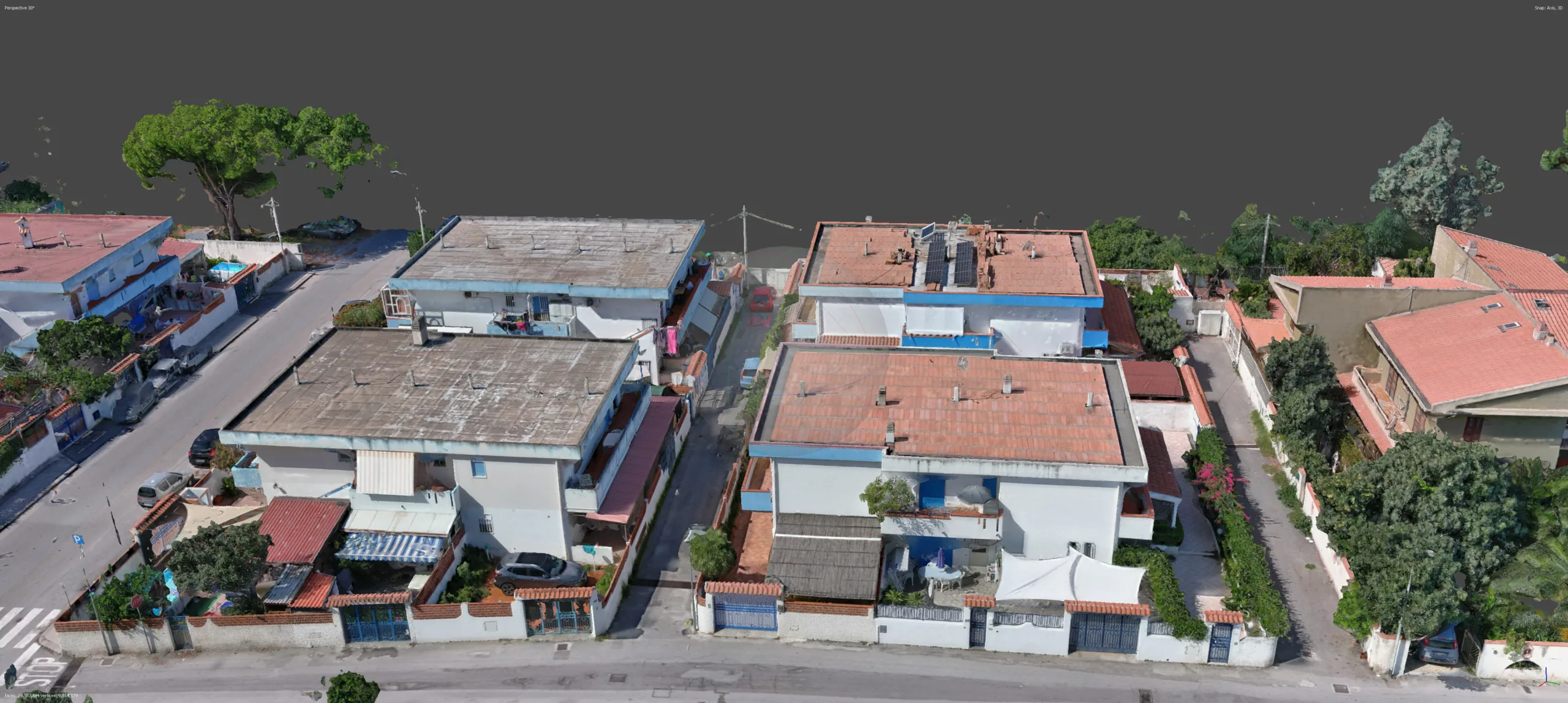
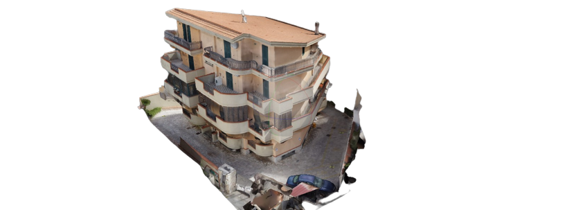
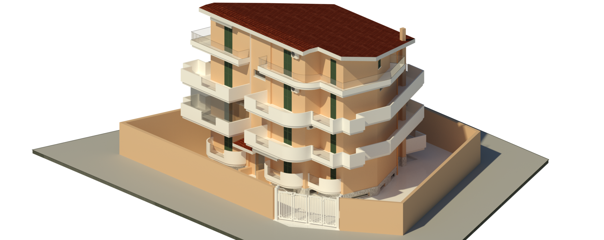
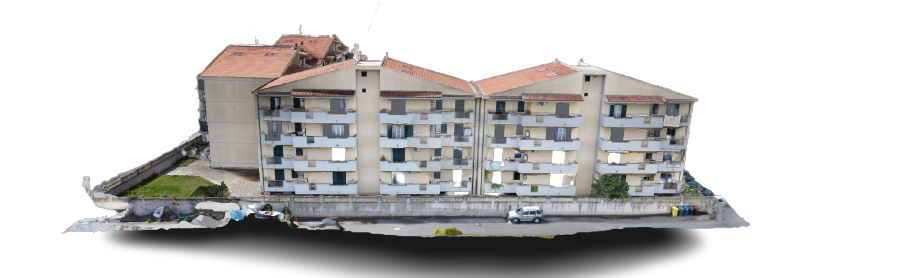
We create digital terrain models DSM (Digital Surface Model), i.e. surface models (including any buildings, trees, etc.) and DTM (Digital Terrain Model), i.e. model of the terrain cleaned of any upper bodies. Surveys of this type are used to immediately understand the lay of the land based on its altitude.

Do not hesitate to contact us to find out how we can support your business.

We are always ready to support our customers at every stage of the project, providing technical assistance and professional advice. Our attention to detail and our care for our clients has allowed us to build a reputation for reliability and professionalism in the sector.

Reliefs of the facades

Together with you, we will evaluate the relief method that best suits your needs and provide full refund on any request.

CONSTRUCTION MONITORING WITH DRONE

We offer periodic survey services with the use of drones and 360° cameras to acquire external and internal images of the construction site, which are made available through a cloud platform.

Ask for a FREE survey evaluation

The numbers speak

0
Satisfied customers
0
Flight hours
0
Surveys carried out

Our promise of commitment and quality for the
success of your projects

We know that our customers rely on us to obtain concrete and quality results. For this reason, we focus fully on completing each project entrusted to us, dedicating the time and resources necessary to achieve the set objectives. We are convinced that commitment and perseverance are the keys to obtaining excellent results, and for this reason we are fully committed to every phase of the work, from planning to final delivery. With our professionalism and our determination, we are ready to guarantee our customers the success of their projects, leaving them with the satisfaction of a job well done.

Address:

Via Policastrelli, Italy, Sicily, Milazzo

E-mail:

info@fly4me.it

Opening time:

24/24 7/7

Contact us now

en_USEnglish